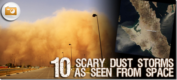
A sea of dust approaches
You’re driving along a desert highway when almost without warning, blinding, choking dust surrounds your car, filling the air with detritus. You pull your car off the road, kill the lights and wait it out. What happened?
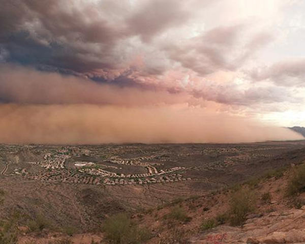
Dust storms are an increasingly common problem in the world as arid conditions leave behind mounds of dry, loose soil. As climate change and water shortages work in tandem, some experts wonder if we've set ourselves up for a 21st-century Dust Bowl. Pictured here is a monster dust storm engulfing Phoenix, Arizona [USA], on July 31, 2011. This is what these storms look like here on Earth, but NASA offers a different view of these incredible storms from space. Here are 10 images of these magnificent forces of nature as seen from above. (Text: Katherine Butler)
1. A perfect storm
For centuries, China experienced intense dust storms every 30 or so years. But since 1990, they now occur every year because of deforestation and extreme water use. Pictured above is a dust storm in China that was so powerful that it “blocked enough sunlight to leave the skies as dark as midnight, and reduced visibility to roughly 20 meters (65 feet),” according to NASA. The April 7, 2001 storm was so intense that it created its own topography with “ridges of dust” rising up within the cloud itself. In fact, this storm carried dust across the Atlantic Ocean, landing in Maryland [USA]. The image was captured by the Moderate Resolution Imaging Spectroradiometer (MODIS) on NASA's Terra satellite.
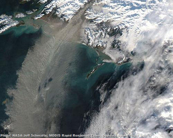
2. Dust storm off Alaska
Dust storms don't only occur near the desert. On Nov. 5, 2005, this storm of glacial sediments was spotted over the Gulf of Alaska. Glacial sediments form when “the movement of glaciers grind the rocks below them to fine silt,” according to NASA. This image was taken by the Moderate Resolution Imaging Spectroradiometer(MODIS) on the Aqua satellite.
3. Dust storms in Mexico
On Nov. 27, 2011, a series of dust storms blew off Mexico and the Baja California Peninsula. This image was taken by the Moderate Resolution Imaging Spectroradiometer (MODIS) on NASA’s Aqua satellite. The MODIS instrument is part of NASA’s mission to understand the global dynamics of the Earth. This imaging device circles the globe on board the Aqua and Terra satellites every one to two days, acquiring information “across 36 spectral bands, or groups of wavelengths.”
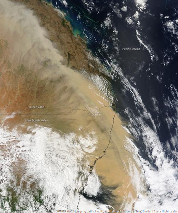
4. Dust over Eastern Australia
A gigantic Outback storm swept through Australia on Sept. 23, 2009, and it was thought to be as much as 500 kilometres (310 miles) wide and 1,000 kilometres (620 miles) long. Residents experienced red skies, hail and gale-force winds in what was called Sydney's worst dust in 70 years. The storm was thought to be the result of the multiple-year drought. Here we see the storm as imaged by the MODIS on NASA’s Terra satellite.
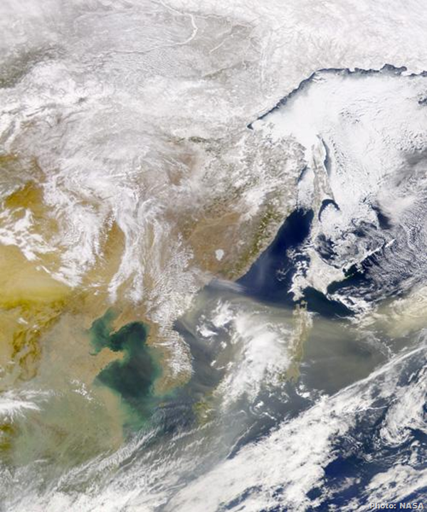
5. Dust cloud over Sea of Japan
This image was taken on March 18, 2002, after a massive dust storm coated much of Beijing with a fine layer of dust. Incredible dust storms have become a yearly event for city residents, who call the arrival of dust from the deserts of Mongolia the “shachenbao or “dust cloud tempest.” These storms are believed to be the result of deforestation. Almost 1 million tons of dust blows across China each year, according to NASA. Here we see the dust as it swirls over the Sea of Japan and onto the Pacific.
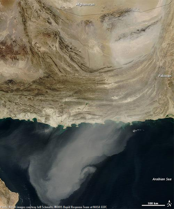
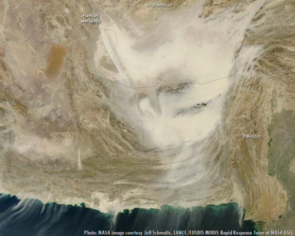
6. Dust storm over Iran, Pakistan and Afghanistan
On Dec. 5, 2010, a massive dust plume appeared over the Arabian Peninsula after a tremendous storm swirled over Iran, Afghanistan and Pakistan. Here we see the plume as imaged by the MODIS on NASA’s Aqua satellite. Pakistan often experiences massive dust storms, but in an ironic twist, this area was still in recovery from extreme flooding from damaging monsoons when the dust storm hit.
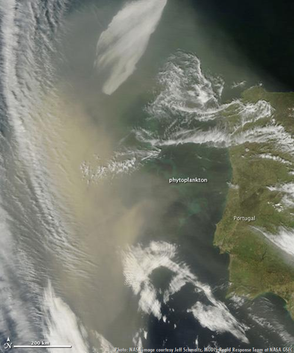
7. Saharan dust off Portugal
This is a plume of dust swirling into the Atlantic Ocean as imaged by the MODIS on NASA’s Terra satellite on April 6, 2011. You can also see a phytoplankton bloom in this photo. While dust can cause major havoc, it also has life-giving qualities. Dust carries iron, which fertilizes the world’s oceans; when waters are “iron-poor,” phytoplankton can proliferate.
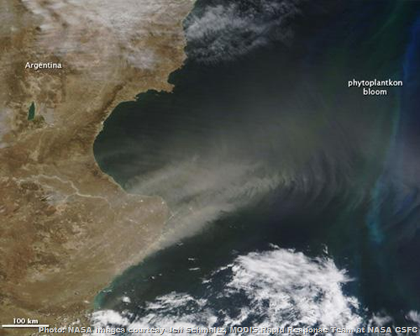
8. Patagonian dust over the Atlantic Ocean
On Jan. 24, 2010, a thick cloud of dust was spotted swirling off southern Argentina into the Atlantic Ocean. Here we see it imaged by MODIC on-board the Terra satellite. Air turbulence is the reason the plume rippled across the ocean, inciting a phytoplankton bloom feeding off the iron in the dust. Later that day, the Aqua satellite photographed the same area, showing the dust concentrated over the Atlantic.
9. Afghanistan dust storm
Dust storms are a common occurrence in Afghanistan, where during the summer residents endure as much as six days a month of blowing dust. Here we see a massive cloud of dust swirling through the country on Dec. 20, 2011, as imaged by the MODIS instrument on-board the Terra satellite.
While such events are more common in other parts of the globe, the U.S. is starting to consider the impact of dust. As dust storms increase in the West, experts are looking for a solution. Jayne Belnap, a U.S. Geological Survey research ecologist in Moab, Utah, told the New York Times, "We do not manage for dust. We don't even think about it. [But] I think the time is coming where we are going to have to decide we need to think about dust."
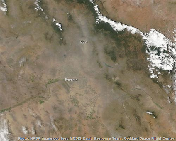
10. Dust storm in Phoenix
The dust storm of late July 2011 in Phoenix [USA] was well-documented, but it was not the first to engulf the area. Here we see another dust storm over Phoenix just weeks earlier on July 5, 2011. Here we can see the remnants of an immense storm that included a mile-high, nearly 100-mile wide storm that swept through the area at 50 to 60 miles per hour. The storm shut down the city’s airport and caused massive power outages in the area.


No comments:
Post a Comment
Please adhere to proper blog etiquette when posting your comments. This blog owner will exercise his absolution discretion in allowing or rejecting any comments that are deemed seditious, defamatory, libelous, racist, vulgar, insulting, and other remarks that exhibit similar characteristics. If you insist on using anonymous comments, please write your name or other IDs at the end of your message.