1. Uncommon tempest
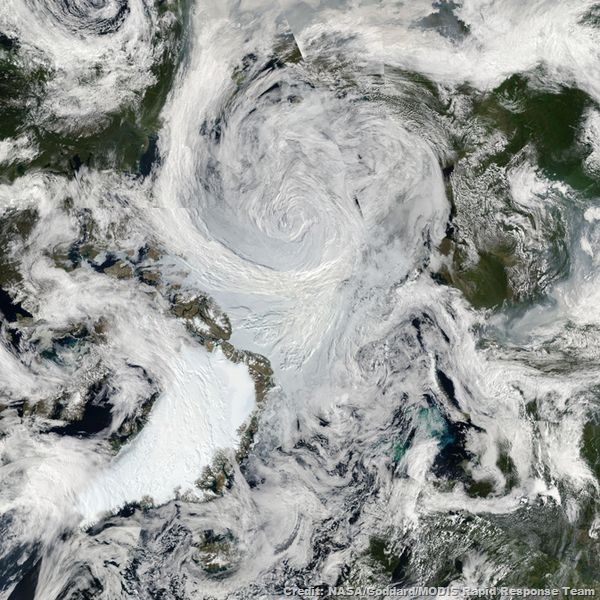
An unusually strong storm formed off the coast of Alaska on Aug. 5, then moved over the central Arctic, where a NASA satellite took pictures of it that have been pieced together into a mosaic of the stunning sight.
The Moderate Resolution Imaging Spectroradiometer (MODIS) on NASA's Aqua satellite took the images that make up the mosaic during various passes over the North Pole on Aug. 6, when the storm was swirling over the middle of the Arctic Ocean.
2. No passage allowed
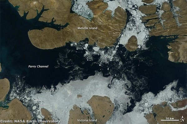
Sea ice has melted and part of the Arctic's Northwest Passage has opened, images captured by NASA's Terra satellite show.
The Canadian Ice Service reported that ice cover in Parry Channel began to fall below the 30-year median level in mid-July, and the melting sped up in the following two weeks. At the end of July, there was only an ice cover of 30 percent, compared to a median of 79 percent.
3. Evidence of a crash
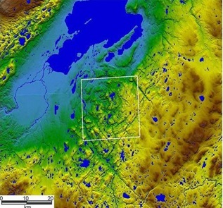
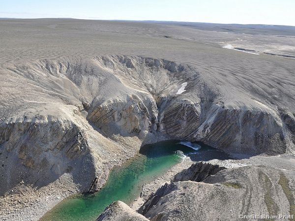
Researchers in Canada's western Arctic have found evidence of a crater that formed when a huge meteorite slammed into Earth millions of years ago.
Measuring about 15 miles (25 kilometres) across, the formation was named the Prince Albert impact crater after the peninsula where it was discovered. Researchers don't know exactly when it was created, but evidence suggests the crater is between 130 million and 350 million years old, according to a statement from the University of Saskatchewan.
4. Ernesto hits the Yucatan
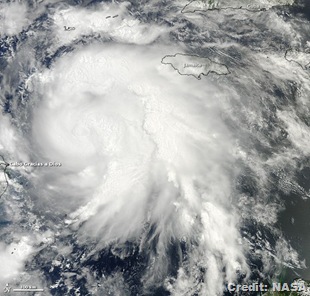
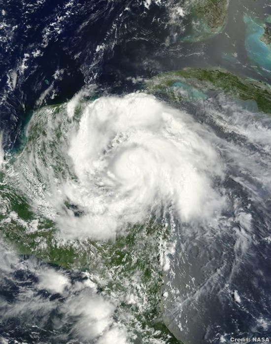
NASA's Terra satellite snapped a picture of Tropical Storm Ernesto as it swirled over Mexico's Yucatan Peninsula late yesterday afternoon (Aug. 7).
As its centre has moved over land, Ernesto has steadily weakened and now has winds of 50 mph (85 kph). But while its winds have weakened, it has still produced considerable rain.
5. More than a century coming
The late-night eruption of New Zealand's Mount Tongariro volcano on Monday (Aug. 6) was spotted by a NASA satellite just an hour after it began.
The eruption was a short-lived phreatic one, New Zealand volcano monitoring authorities said. Phreatic eruptions are stream-driven eruptions that happen when water beneath or above the ground is heated up, potentially causing it to boil and "flash to steam," creating an explosion, according to the U.S. Geological Survey.
6. A ghostly glowing
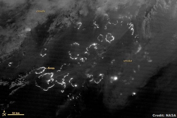
A satellite captured eerie images of wildfires burning through the night in the far reaches of Siberia, a region regularly racked by massive burns during the summer months.
In the black-and-white photograph, the landscape is peppered with glowing lines that resemble the simple shapes of clouds one might see in a child's drawing - the outlines of burns that officials say cover up to 90 square miles (233 square kilometres) of eastern Siberia, but that actually may be far more widespread.
7. Last shot
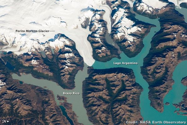
An astronaut aboard the International Space Station snapped this photo of the Perito Moreno glacier, in Argentina's Andes Mountains, just before a dam of ice it creates burst.
Perito Moreno is perhaps the region's most famous glacier because it periodically cuts off the major southern arm (known as Brazo Rico) of Lake Argentino, by forming a natural dam with its ice tongue; this prevents water from transferring between the two bodies of water.

No comments:
Post a Comment
Please adhere to proper blog etiquette when posting your comments. This blog owner will exercise his absolution discretion in allowing or rejecting any comments that are deemed seditious, defamatory, libelous, racist, vulgar, insulting, and other remarks that exhibit similar characteristics. If you insist on using anonymous comments, please write your name or other IDs at the end of your message.