
1. Beautiful chaos
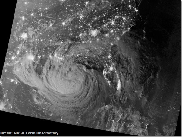
A NASA satellite captured a spectacular photo of what is now Hurricane Isaac from space, a night-time view showing the then-tropical storm's clouds lit up by moonlight as it approached the U.S. Gulf Coast.
NASA's Suomi-NPP weather tracking satellite recorded the amazing night-time photo of Isaac just after midnight on Tuesday (Aug. 28). The bright city lights of New Orleans, Houston and Tampa, Fla., can be easily identified, but the photo also includes lights from cities all along the Gulf Coast, Florida and the southeast U.S. coast.
2. Rough arrival
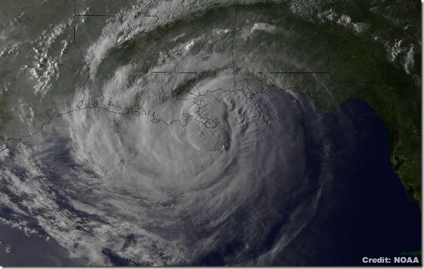
Hurricane Isaac made two landfalls late last night (Aug. 28) and in the wee hours of this morning, and NASA satellites caught the whole show from their perch in orbit.
Isaac made its first landfall over a small spit of land in Plaquemines Parish in southeast Louisiana at 7:45 p.m. EDT (1145 UTC) before re-emerging over water. It stalled over waters near the Louisiana coast for several hours before making its second landfall at 2:15 a.m. CDT (0715 UTC) just west of Port Fourchon.
3. Perspectives
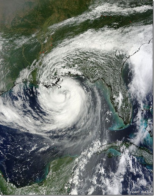
Goddard MODIS Rapid Response Team Several different satellites are keeping a keen eye on the Hurricane Isaac, which has made landfall along the Louisiana coast nearly seven years to the day after Hurricane Katrina began laying waste to New Orleans.
Imagery from NASA's TRMM and Terra satellites and the GOES-13 spacecraft, operated by the National Oceanic and Atmospheric Administration, showed Hurricane Isaac's outer bands lashing the Gulf Coast earlier today (Aug. 28) before the huge storm came ashore.
4. Small start
A giant panda cub born recently at the San Diego Zoo has received its first veterinary exam, the announced late last week.
The quick, 3-minute exam allowed staff just enough time to determine that the cub is healthy, thriving and weighs 1.5 pounds (0.7 kilograms). Vets were able to listen to the cub's heart and lungs, both of which sounded good, but were not able to determine its sex.
5. Tempestuous oceans
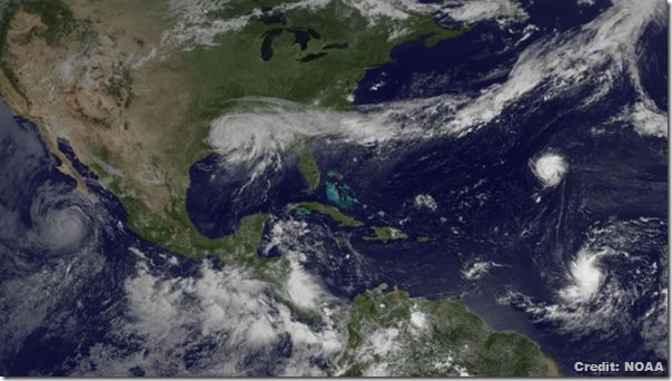
Four tropical cyclones are swirling across the two oceans that sandwich the United States, and a satellite recently captured a portrait of all four storms.
The image, snapped by the GOES East satellite this morning (Aug. 30), shows massive Tropical Storm Isaac hovering over the Gulf Coast. The storm has weakened as it has moved inland, but the slow-moving storm is still causing devastating flooding.
6. Strange seepage
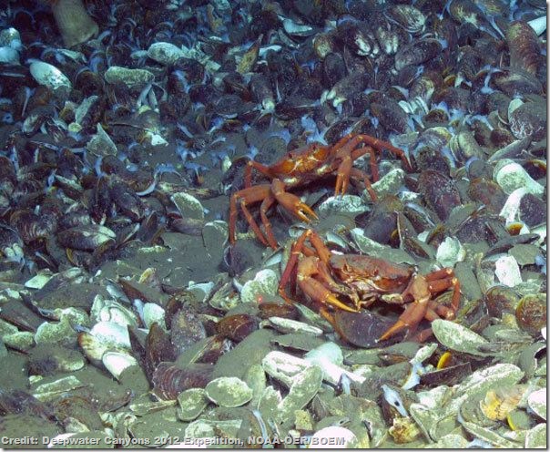
In the early 1980s, a researcher snapped some surprising photos while tugging an instrument behind a boat. The pictures showed evidence of natural gas seeping out of the seafloor, an occurrence that was unheard of off the U.S. East Coast at the time. But due to technological limitations, the researcher wasn't able to pinpoint the location on subsequent expeditions.
Picking up where the trail went cold, researchers used clues from these photographs to find the seep in a seafloor canyon off the coast of Maryland some 1,360 feet (450 meters) beneath the ocean.

No comments:
Post a Comment
Please adhere to proper blog etiquette when posting your comments. This blog owner will exercise his absolution discretion in allowing or rejecting any comments that are deemed seditious, defamatory, libelous, racist, vulgar, insulting, and other remarks that exhibit similar characteristics. If you insist on using anonymous comments, please write your name or other IDs at the end of your message.