Comet PanSTARRS debuted in the north, colourful airglow in the south, and a diminishing water reserve in the Middle East.
1. PanSTARRS’s Northern Debut
Photograph by Babak A. Tafreshi, TWAN
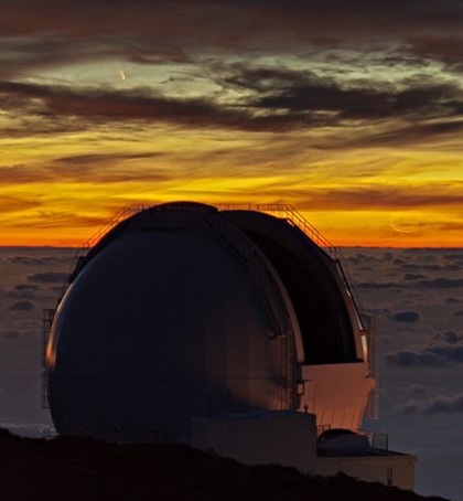
As the distorted crescent moon sets near the horizon, the newly discovered comet PanSTARRS (upper left) makes its first appearance in the Northern Hemisphere on March 12, setting behind the William Herschel Telescope during a cloudy evening in La Palma, California.
The comet, which had grazed through the sky in the Southern Hemisphere for several months, is visible to the naked eye and is said to be brighter than any other comet seen in recent years.
2. Running Dry
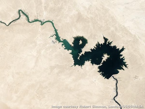
An image taken in 2006 by the Landsat 5 satellite of Iraq's Qadisiya Reservoir shows the abundance of water in the man-made lake nestled along the Euphrates River.
An image taken three years later reveals the massive depletion of the freshwater reserve - a result of pumping groundwater faster than natural processes can replenish it. Both images were released this week by NASA. (Read: 8 Mighty Rivers Run Dry From Overuse)
Researchers found that between 2003 and 2009, the Tigris and Euprhates river basins lost 117 million acre feet of freshwater, roughly the equivalent to the volume of the Dead Sea. Only one-fifth of the loss was due to natural causes like the shrinking of snowpack and the drying up of soil during the 2007 drought in the Middle East.
"That's enough water to meet the needs of tens of millions to more than a hundred million people in the region each year, depending on regional water-use standards and availability," lead researcher Jay Famiglietti at the University of California, Irvine told NASA.
3. Colourful Airglow
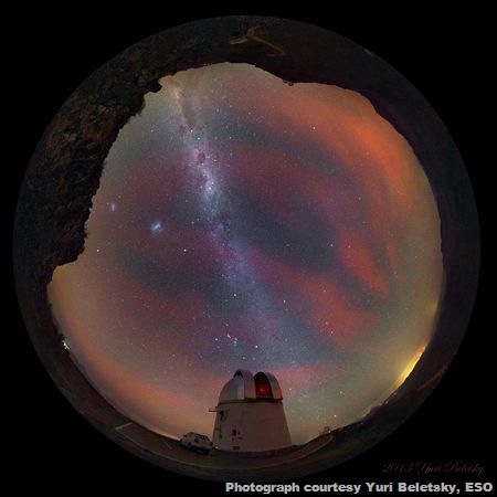
An unusually bright airglow is captured at Las Campanas observatory in La Serena, Chile by astronomer Yuri Beletsky of the European Southern Observatory.
Airglow is the glowing of the atmosphere, caused by the release of energy from the various atoms, molecules, and ions excited by the Sun's ultraviolet rays. Unlike the aurora, which is only visible in high latitudes, airglow can be seen from all over the globe and is brightest at 10 to 15 degrees above the horizon.
While the light emitted is very colourful, as pictured above, airglow appears mostly green and yellow to the unaided eye because the other colours are outside human visible spectrum.
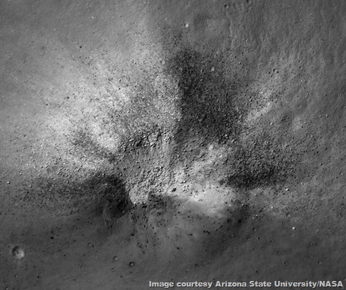
4. Asymmetrical Impact Crater
Pictured is an asymmetric impact crater found in the in the moon's Lassell Massiff region, a red spot that astronomers believe harbours pyroclastic, or volcanic, material, speaking to the moon's volcanic history.
5. Comets’ Tails
Two comets, the PanSTARR and the Lemmon, move across the southern sky on March 5, during sunset at the Paranal Observatory in Chile's Atacama desert.
Trailing behind the PanSTARR comet near the horizon is a tail caused by comet dust reflecting sunlight. Above the right slope of the mountain are the glowing green ions of fainter Lemmon comet's tail. Both tails point toward the recently set sun.
And at just the right time in the right place, a shooting star whizzes between the two comets, burning up in the atmosphere.
6. Street of Clouds
Known as cloud streets, clouds formed over the Davis Strait - between Greenland and Canada in the northern Labrador Sea - during late winter align with the direction of the wind in a parallel pattern.
When the arctic air moves over the warm, open water of the strait, the mix of rising moist air and the temperature difference results in streaks of clouds.
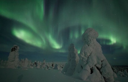
7. Riisitunturi Park
Photograph by Bernd Pröschold, TWAN
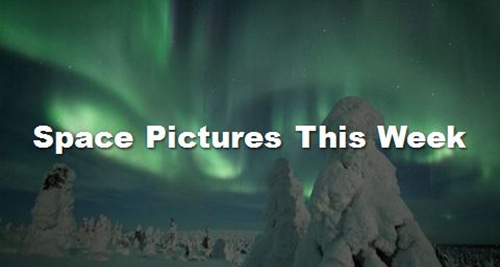
A vibrant green aurora flashes in the clear night sky behind the "Tykky" sculptures, or "frozen" trees, in Finland's Riisitunturi National Park. The park's forests are especially well known for their snow-covered trees, which appear almost surreal when the moonlight is blue.
During the winter in the Lapland, the most northern region of Finland, snow accumulation ranges from 23 inches (60 centimetres) to more than 35 inches (90 centimetres).


No comments:
Post a Comment
Please adhere to proper blog etiquette when posting your comments. This blog owner will exercise his absolution discretion in allowing or rejecting any comments that are deemed seditious, defamatory, libelous, racist, vulgar, insulting, and other remarks that exhibit similar characteristics. If you insist on using anonymous comments, please write your name or other IDs at the end of your message.