Striking Pictures From International Space Station Reveal Gorgeous Earth
By Brian Clark Howard, National Geographic News, 14 November 2014.
By Brian Clark Howard, National Geographic News, 14 November 2014.
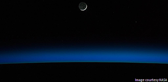
These images from the International Space Station shed light on our dynamic planet.
1. Midnight Sun
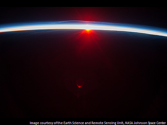
"There are strange things done in the midnight sun," Canadian poet Robert Service wrote in 1907. Above, astronauts witnessed the phenomena first-hand from the International Space Station, which orbits roughly 205 miles (330 kilometres) above the Earth's surface.
Astronauts made this image looking north across the Aleutian Islands, 20 minutes after local midnight in early August 2013. The space station was in its "top of the orbit," according to NASA, the northernmost latitude it reaches (51.6 degrees north). The Aleutian Islands are not visible on the dark side of the day-night line.
The thin clouds above the midnight sun are known as noctilucent clouds (night-shining clouds) or polar mesospheric clouds, since they occur over the poles during the summer. Astronauts describe them as among the most beautiful sights from space. According to NASA, data suggest the clouds may be getting brighter and appearing at lower latitudes as a result of global warming.
This photo and those that follow were all made by astronauts from the International Space Station since last year. The station launched in 1998 and is a project of five international space agencies, in the United States, Russia, Canada, Japan, and Europe. The station supports a crew of up to six people and has orbited the Earth more than 90,000 times, playing host to wide variety of scientific experiments and observations. (See more space station photos.)
2. Swirling Desert
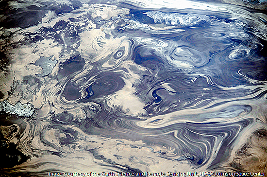
On February 14 astronauts on the International Space Station photographed this striking pattern in central Iran's Kavir Desert. According to NASA, the lack of vegetation and soil allows the natural folding patterns in the rocks to be seen from space.
Dark patterns in the image indicate lakes or streams. The width of the land seen in the photo is about 65 miles (105 kilometres). (See more stunning shots of Earth from space.)
3. Desert Coast
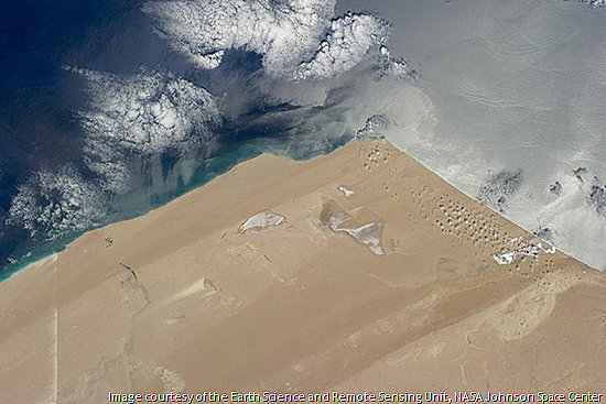
This image captures the arid West African coast jutting into the Atlantic Ocean. Strong northerly winds create the streaks along this 134 miles (215 kilometres) of Saharan coastline. (See how "lost" satellite photos reveal surprising views of Earth.)
4. Ice Fields
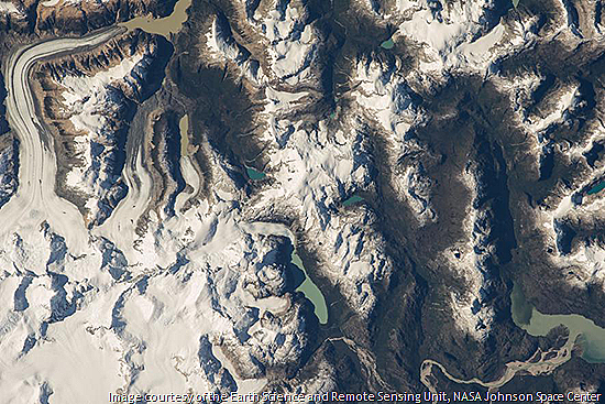
Astronauts made this image of ice fields in Patagonia, in Chile. Many such terrestrial glaciers are quickly receding as temperatures rise around the world. (See more photos of Patagonia.)
5. Frozen River
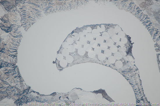
Astronauts captured a frozen bend in the Missouri River last December. The meander forms an 80-mile-long (130 kilometres) reservoir behind the Big Bend Dam near Lower Brule, South Dakota.
The Missouri is the longest river in North America, flowing from the Rocky Mountains of western Montana for 2,341 miles (3,767 kilometres) to its confluence with the Mississippi River north of St. Louis.
6. Human's Eye View
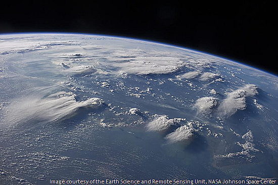
This image was made with a camera with a focal length similar to the human eye, to approximate what astronauts actually see from the International Space Station. It shows thunderhead anvil clouds over Borneo on late afternoon last August.
7. Desert Winds
Prevailing winds push clouds across the Sahara, over a plateau in southern Mauritania, in this picture from last January. Here, winds tend to blow from the northeast (north is to the right of this image).
8. Wide Ocean
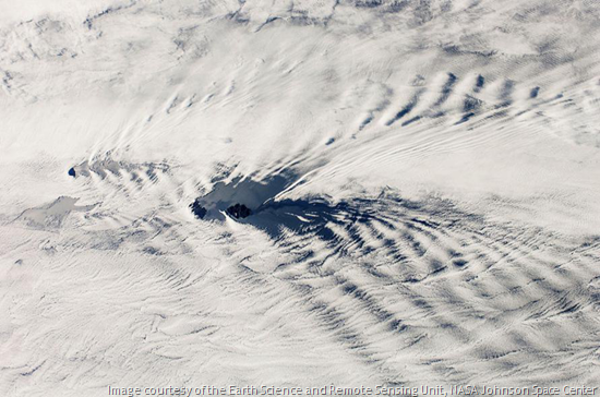
A blanket of bow-wave clouds passes over the southwestern Indian Ocean in this image from last January. Two small, remote islands, part of the French Southern and Antarctic Lands, appear through a break in the clouds in the centre.
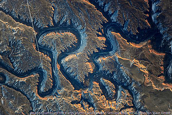
9. Canyon Cutter
The Green River, above, is an important tributary of the Colorado River; their combined flow created the Grand Canyon millions of years ago, about 200 miles (325 kilometres) downstream from this location.
In 1869, explorer and geologist John Wesley Powell named this eastern Utah section of the Green "Bowknot Bend" because of the way the river doubles back on itself. The mushroom-shaped loop near the centre of the picture is ringed by about 9 miles (14.5 kilometres) of river.
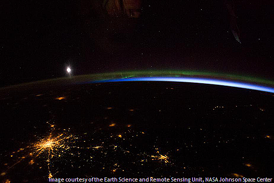
10. Night Colours
The thin green line of an aurora borealis cuts below the moon and above the radial lights of Moscow in this recent night-time image. (See more aurora pictures.)
Photo gallery by Kurt Mutchler.

No comments:
Post a Comment
Please adhere to proper blog etiquette when posting your comments. This blog owner will exercise his absolution discretion in allowing or rejecting any comments that are deemed seditious, defamatory, libelous, racist, vulgar, insulting, and other remarks that exhibit similar characteristics. If you insist on using anonymous comments, please write your name or other IDs at the end of your message.